Maps and Spatial Data
The Real Estate and Survey Unit produces and administrates spatial data for Rauma area, and prepares tailored maps, building supervision maps and thematic maps on request. Maps can be purchased as black and white or colour map printouts, as well as in digital form. Thematic maps can be prepared on request. Depending on the end use purpose, spatial data is available at preferred scale and with required data content.
Digital data can be delivered in preferred coordinate system, but the default system is ETRS-GK22 used by the City of Rauma. Government organisations in Finland normally use ETRS-TM35 coordinate system.
A permit from the copyright owner, City of Rauma is required for using and publishing spatial data of Rauma.
Ordering maps for building permit applications
Maps needed for building permit applications are ordered from the service point Pyyrman. Service point personnel can provide assistance with required maps.
Internet Map service
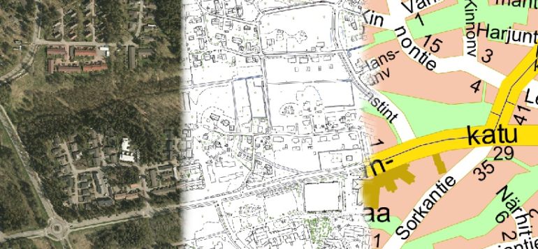
As a background map in the Internet Map Service, you can select either tourist map, base map, topographic map or orthorectified aerial photograph. On top of the selected background map, you can superimpose e.g. cadastral index map, vacant detached house plots, address map, control points, and additional street information like, speed humps, speed limits within city centre, maintenance class, pavement, bicycle lanes and parking zones. Detailed plans and master plans can be shown to the extent they are digitalised.
You can add to the view historical orthophotos and aerial imagery from different years. These historical datasets cover only part of the city area. Location information of control points is useful for planners and builders who need to carry out field surveys. The tool menu includes normal zoom tools and a distance-measuring tool.